
|
|
The 2017 Spring and Summer storm season kicked into gear on May 17th with a low instability high shear set-up. With 100 CAPE and LIs at 0 it didn't look like a day to be thinking about storms, especially with notable CIN in place, however low LCLs and strong deep layer shear qualified this marginal outlook as a day for watching radar and the skies. During the afternoon a cell formed below the border, slowly moved N, crossed Lough Erne direction and headed into South Tyrone. The cell was red on radar with a white core and shaped almost like the classic Eagle wing form on radar similar to highly sheared cells in the USA, in other words this storm was venting its precip well away from the updraught base and became highly organized, in short it had low topped supercell traits, it moved over Omagh with an intense core then produced lightning over the S. Sperrins. I was watching it on radar while exchanging chat with John Fagan and Paul Martin. The cell was moving NE and still alive and well after living for almost two hours, it was making a beeline for Glenshane Pass so I drove out the road for a look and ended up spending the rest of the day going up and down this road observing cloud bases from the shoulder.
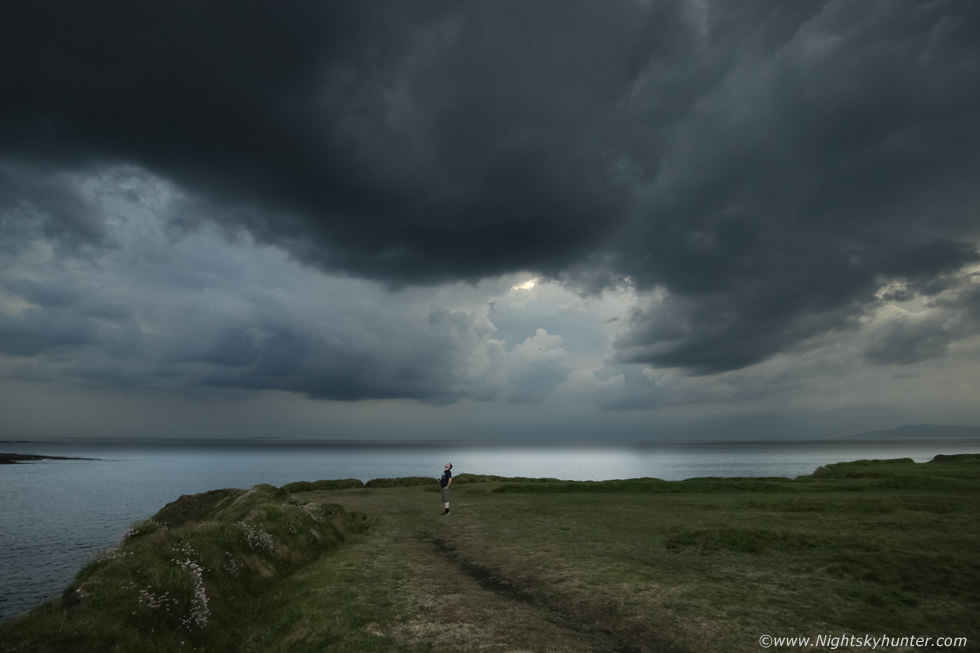
I observed the Omagh cell in the distance to the SW with a low dark base which looked in good form complimented by several new updraught towers on its flank with an extremely long anvil sheared downwind to the NE covering miles of sky ahead it. I waited and waited however the sparks had stopped and the cell seemed to become more outflow in profile until it arrived at the Pass, I watched it creep up on the mountain from the Ponderosa car park sporting good lifting motion, the scud was getting drawn vertically upwards into the base while slowly rotating, not a funnel, more of a scud sucker but interesting to watch without a doubt, these antics kept be amused until the cell died. Then the sun came out with blue skies, solar heating was much stronger than I had expected which really kick started convection into a new life style.
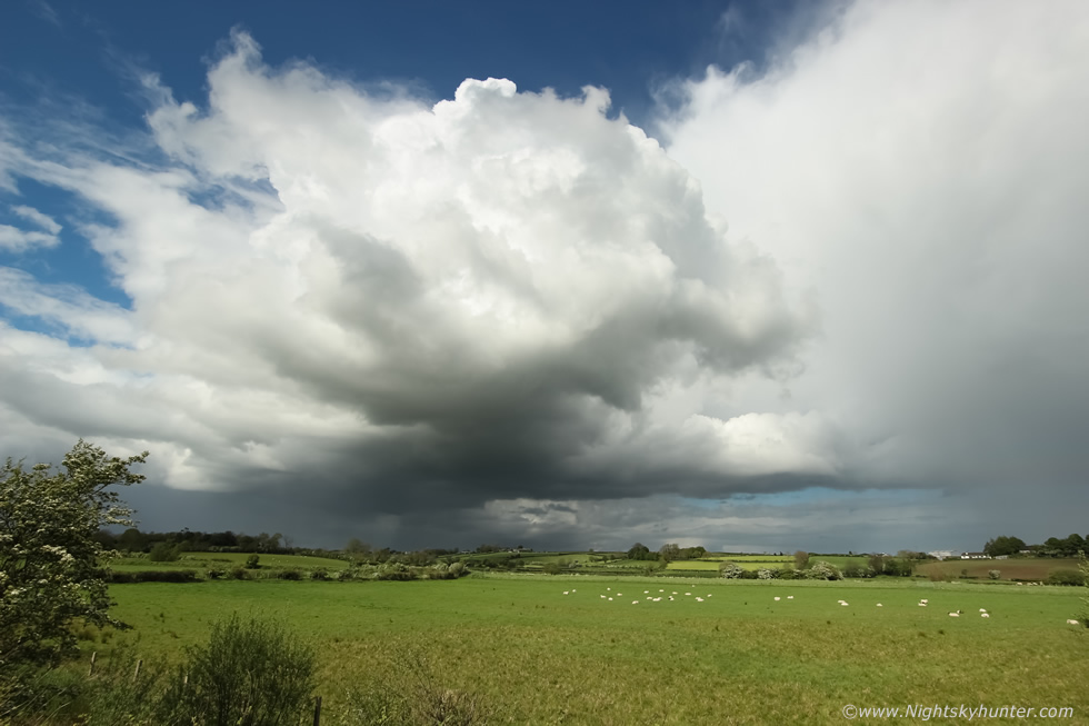 |
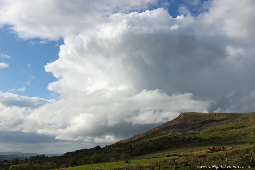
At 16.00 I pulled onto the hard shoulder adjacent to Glenshane Road to watch a line of new towers approach from the SW however my attention was soon stolen by a more photogenic cell behind me close by to the E so I got out of the van for a look. Convection bubbled to life in the warm afternoon sunshine and soon a cell was born, this is 10mm wide angle, believe me this was much bigger than it looks, moving L to R and into the distance.
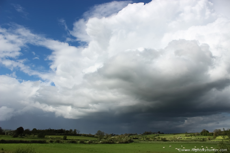 |
I set up my Go Pro on the grass verge and let the video record in the hope of getting a short time lapse. I switched to the 18-55mm kit lens for a closer view which was more like what I saw with the naked eye. This was me in my element, there is nothing I love more than standing watching convection with the sun burning your neck and face with blazing white towers building over the green landscape, I could have stayed here forever, so peaceful and sublime. Those towers were fairly solid too, you can see the tops starting to anvil, I could have chased after it however I knew I would end up with an obstructed view so I stayed here in the countryside and took in the sight as the cell moved into the NE. The shear and CAPE were waning by late afternoon in the midlands so I returned back home feeling content, it was time very well spent and not a bad day at all for such a marginal set-up, furthermore there would be another chance tomorrow with higher CAPE and that was a day which I had my heart set on.
 |
May 18th turned into a massive disappointment, at least it seemed at the time. Best CAPE of the year, convergence and a little shear, from studying the models I suspected the midlands and W midlands would get storms during the early afternoon followed by the E later in the day. I chose the Sperrins has a target area. I drove to the top of Benbradagh where I spent hours and hours watching convection and cloud bases while eating cashew nuts and drinking water. I had the Go Pro set-up in a field doing video time lapse of growing cells to the SW moving up, there was no shortage of convection and showers yet something was not rite. Give the good solar heating and CAPE there should have been decent developments, however all the clouds seemed devoid of any life at all, their bases were extremely high off the surface which resulted in ugly clouds which were entirely unphotogenic and the towers were small and weak with no crisp edges and seemed stagnant. As the hours ticked away my visions of storms were gone, this was rubbish, I was weather beaten, my eyes stung from the sunshine and from watching clouds through the binos, I could have passed out to blissful sleep in the van. I shot images of what I could but it was a bit pathetic and I felt cheated and frustrated by nature. The sky has been so quiet since last October to the present, I had been dreaming of Summer for storms and this is all I was offered?. I watched until I lost heart then drove back to Maghera by late afternoon feeling exhausted and let down (I should have known better after all these years but I still get too excited by the chance of a storm).
I rested or a while, washed, got dinner and went back on the radar like a hound who had just picked up the scent of a fox. Radar showed scattered but strong showers in my area, solar heating was good and there was still CAPE present until late evening. I decided I would go back out, this time with a different attitude, I would not expect to see anything, just enjoy the sun and perhaps do a time lapse for training purposes or shoot a nice sunset. My Mum came along with me so we drove back to the summit of Benbradagh outside Dungiven once more. En route up the mountain road this cell suddenly exploded, it was actually the best cell I had seen all day, solid white clouds and definitely surface based now, it had more life so perhaps cooling cloud tops and a weakening cap had a roll to play. The cell passed behind Benbradagh so we went to the top and watched it depart to the NE with a vivid rainbow base over the distant wind turbines. I turned around to face SW, two hours before sunset, a line of dry high based towers had moved into position perhaps 10-15 miles away, I personally cannot abide high bases - unless they are producing a night time lightning show - however there is one advantage to their presence in daylight, if they produced a funnel the vortex would be much more readily observed compared to a very low base hidden by hills and trees. The wind had turned slack, I knew conditions were good, then suddenly a funnel cloud formed to my SW.
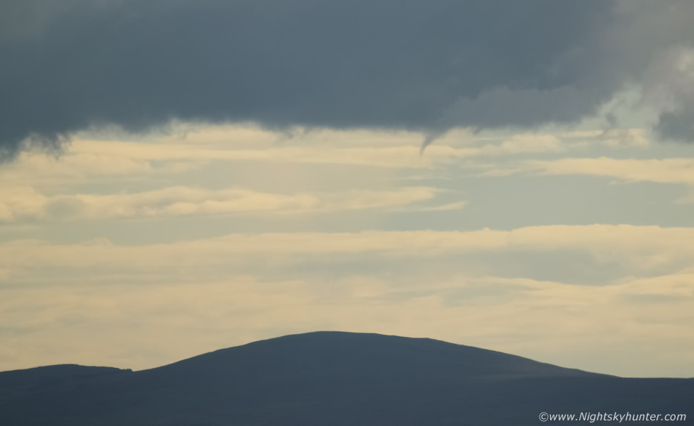 |
It was small and never came down very far however there was no question about what it was, I snapped away with the 100-400mm lens while watching it change shape through the viewfinder, it curved gracefully in the sky, smooth and solid and for a few precious seconds I held my breath as it seemed to hang unsure of what to do next, it looked like it was going to go lower and with a clenched jaw I watched and waited hoping it would go down lower, however it decided it had seen enough then slowly retreated back upwards into the base and even turned into a needle funnel before vanishing into thin air, it was visible for several min's and Mum and I had enjoyed every second of it. Images don't do it justice, it was miles away behind the wind turbines, perhaps between Dungiven and Limavady however it was an obvious sight to the naked eye.
 |
Despite it's small stature it was still a funnel cloud and my first sighting of the 2017 season, caught in middle of the silent mountains on a warm evening before sunset with the last heat and instability of the day, and my Mum got to see it too, I couldn't have asked for better than that, what a contrast to earlier when I was feeling sorry for myself, thank you nature for this special treat. We watched the sun go down and I returned home, I soon found out through social media that another witness had observed the same funnel from Tobermore and even classed it as an ''obvious sight''. I have to admit that despite seeing amazing bigger funnels in past years this still gave me a buzz, I had got my fix - sort of - and now that I had the taste I wanted more.
 |
May 20th and only two days after the funnel sighting another set-up had me out for yet another local chase. Moderate CAPE, weak shear, but again convergence to the W with unstable air lasting into the late evening. Once more the charts looked good for the midlands and W during peak heating hours and the E in the evening. I was on the road at midday parked at Oak leaf filling station on Glenshane Pass scanning radar updates and communicating with Paul and John who were also watching the skies from Dungannon and Omagh. Downpours broke out early and I quickly became worried that this was going to be a factor which killed this day, if too many showers and cells formed they could merge together into clusters of rain, or worse their outflow would kill off any warm unstable air with clouds shutting off solar heating turning what looked like a fantastic convective day into an afternoon of heavy rain. Thankfully that never happened for once again CIN was stunting the vertical growth of towers.
I drove back to Dungiven and revisited my lucky spot on the top of Benbradagh which offered me a superb elevated view. The hours ticked by, towers bubbled up slowly, it was sunny and warm but the wind was blustery outside so I kept my outside adventures to a minimum to keep sheltered. Yet again the clouds seemed lifeless, they took forever to build and had high bases once again which I knew would end any hopes of getting photogenic cloud structures however I never gave up and put in the hours as I munched on a new bag of cashew nuts. I scanned cloud bases on the horizon with the 25x70mm binoculars and never took my eyes off the sky once, I was hungry for another convective catch, however at times I had to act normal. Several people walked past me and a few drivers parked near by to admire the view, I tried to blend in but as soon as a new base appeared I was back out with the camera and binos looking like a nutter, thankfully they left me alone and I was back to peaceful solitude once more.
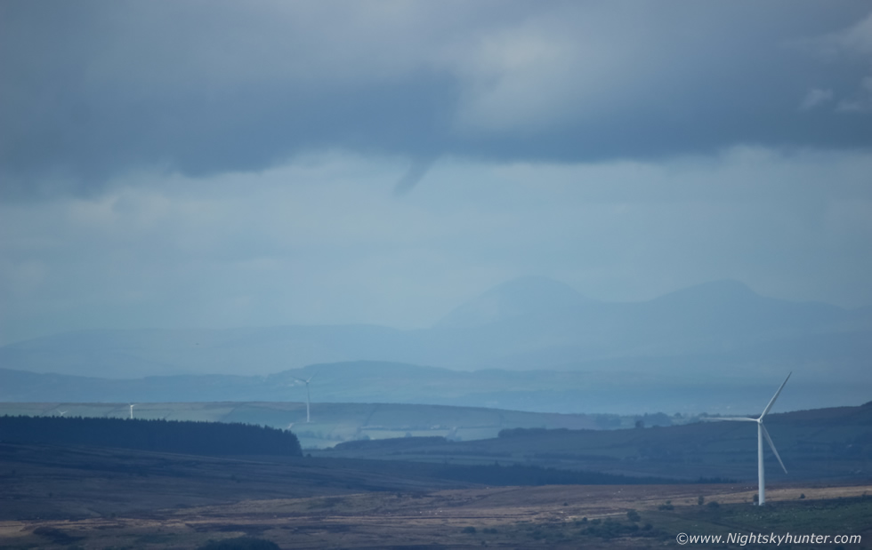 |
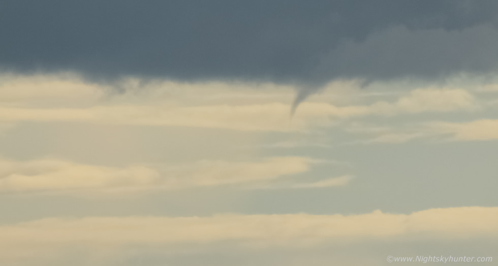
Then I couldn't believe it, I saw another funnel cloud, once again to the SW and yet again near the wind turbines between Dungiven and Limavady, what are the odds of two funnels two days apart over the same part of the country. This funnel was much a broader entity, solid and well defined once again like a cloud finger extending down from the sky, and similar to my last sighting, it formed under a very high base from a small towering Cu with no rain falling at all, I call them dry cells, cold air funnels are more likely to emerge from dry rain free bases in comparison to a wet cold base getting under cut by precip from a mature or post-mature cell. Both of these funnels were formed by surface convergence, a SWly flow meeting an onshore sea breeze which becomes the focus point for convection and rotation, however there was something else at work here. I suspect that the landscape here was just as important as the air aloft, perhaps wind passing through valleys and over hills created a land induced vortex, if this is the case then I will pay more attention here in the future.
The funnel changed shape then dissipitated after a couple of minutes, my second funnel of the season within three days, I felt like I was on a role. I met Roisin and we had dinner in the evening then when we drove through Cookstown we spotted a stunning updraught tower to the W over the Sperrins in the direction of Benbradagh, the tower looked huge back lit by the sun with solid edges and could be seen growing by the second while shear aloft began to tilt it over, I really should have time lapsed it, however we gave chase out the road to get away from town and found a better view along the country roads but by the time we found a good spot the tower had dropped with the setting sun, still, it was an impressive sight to end the day. Thunderstorms broke out in the E where the cap had broke with sferics plotted near Belfast, Ballymoney and the North Coast. I never heard a single rumble of thunder during all these recent chases, however I did get two funnel clouds and those made for mighty fine trophies to put on the convective shelf.
 |
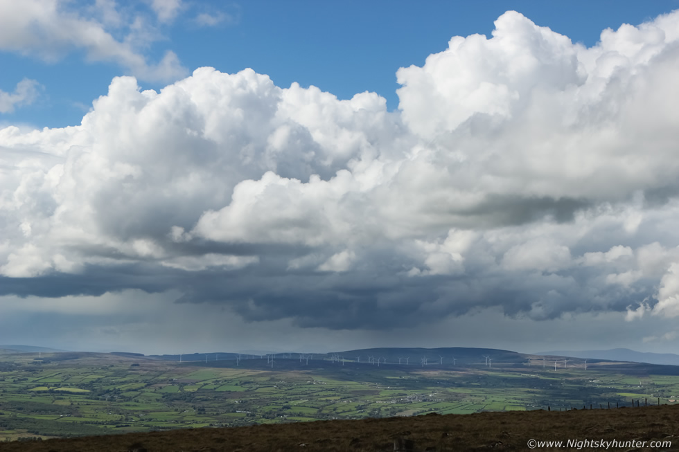
May 26th, this was the biggest set-up of the year so far, high pressure, warm weather every day, temps 26C, an unstable plume had advected from Spain in a SEly flow wedged between a ridge to the E and frontal system to the W. High resolution models indicated 2000 CAPE and a lifted index of -7 with deep layer shear, furthermore there was obvious convergence all along the W coast. A cap would stop storms from forming over land however cold air aloft from the off-shore cold front to the W and lift/forcing from a trough associated with the front would likely erode the cap and form storms, if surface based storms formed they would have supercell traits, it would be our ultimate chance this season to get great storm structure with an added tornado risk. Warnings were issued and ESTOFEX had a level 1 for a large hail threat. Models showed the best chances of storms to be in the W and NW. The Met Office and other sources were also going for overnight storms. This looked to be a big exciting chase, Paul Martin, John Fagan and I soon arranged a chase, it had to be done. The plan was to get daylight surface based storms with structure then stay out during the night for elevated lightning.
It was very warm and humid, the blue skies made the sun feel very intense, I packed bottles of water to stay hydrated, tea, snacks, then warm clothes for later. I hit the road at midday and met John Fagan in Dungannon at 13.00, we then drove to Omagh to meet Paul Martin, while chatting outside we could feel solar heating going to work, a row of small towers were going up by the second in Tyrone however they were still capped, we didn't want to commit too far W just yet incase something fired local. After watching for some time Paul arrived and we got a look at radar, amazingly two storms had already erupted to the W and NW over the sea with great lightning, since nothing was happening inland we decided to drive W to Co. Fermanagh, we stopped in Belleek for a radar update, it was also a good time to discuss our target area and update with the latest info we could find. A line of showers over the W of the country where moving NW for Mullaghmore in Co. Sligo, they were not electrified and we had time to kill so we decided to get something to eat. We needed the energy to be honest, we had dinner in The Forge and had a good laugh, the food gave us a new lease of life so we decided to press on to Mullaghmore.
When we arrived we met Donegal storm chasers Noel Keating and Kenneth McDonagh who had the tripods up shooting the sky. The coastline was covered in cloud with a wall of showery rain blocking our view across the ocean, shame, because on the other side of that rain where two off shore sheared thunderstorms producing prolific lightning!!, the sferics were going mad, we could hear very distant rumbles of thunder, in fact, rumbling for one and a half hours, it was heart breaking to hear them but not see the storms. We all had a great chat anyway about storms and the set-up, then we spotted a new cell to the SW, it had grown from nothing with a long dark base and was heading our way, suddenly it let out a big rumble of thunder (we heard it first guys!) which got a loud cheer from us, we ran back to the jeep and grabbed the gear and set up the cameras. Unfortunately the cell was elevated and not photogenic at all, however it was producing thunder and I observed several blue in-cloud bolts high up in the tower/precip interface. The above image shows this extremely evelated storm passing over Paul Martin who was looking skyward into the base.
This was actually my favourite image from the chase and the only one I will share on the report. I shot time lapse of the cell passing Classiebawn castle then overhead we saw a spinning cloud formation which wasn't really attached to an updraught, however it was extremely cool and reminded me of a pinwheel galaxy. It was so warm and humid and the midgets were biting us good, we stuck it out until the light dropped and the distant thunder stopped. No great photo opportunities for us this time however it was still a technical success, we picked our target area well, got storms with high lightning rates and still had a good time, it was also great to meet Noel and Kenneth again, cant beat meeting like minded people at a great location under storm clouds. The night plume event never happened and we were all tired when we got back home late however it had been a fun day and another storm adventure to add to the list. We all agreed that from now on we wanted surfaced based storms with good visibility, bring on a good post-cold front multicell storm any day.
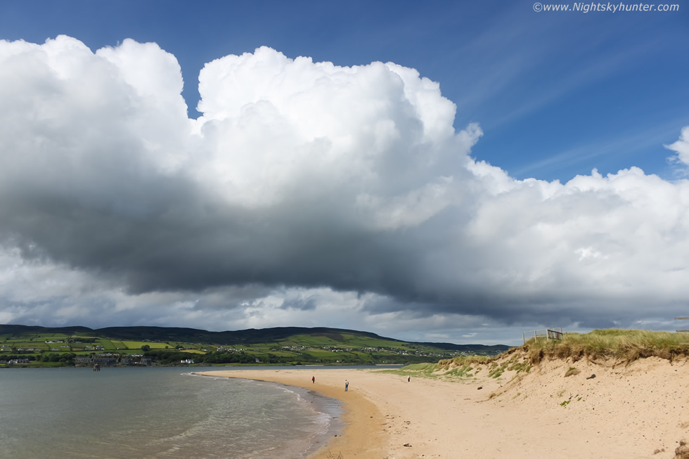 |
June 3rd at Magilligan Point, another unstable day with sea breeze convergence which led me to this area, I was hoping for another funnel cloud or perhaps a waterspout, CAPE was low and a capping inversion was holding the lid on for a while however solar heating was excellent and it wasn't long before convection responded in kind. The towers were expanding by the second like a balloon filling with air, it was such a treat to watch them over this photogenic coastline in a t-shirt with Donegal in the distance. I had the DSLR tripod mounted and standing on the wall beside the Point Bar shooting a time lapse with the Canon taking one image every second, imagine a long waterspout under that dark base slowly moving left to right across the lough, now that would have been some sight and a stunning time lapse, but even without the vortex this made for an excellent training session.
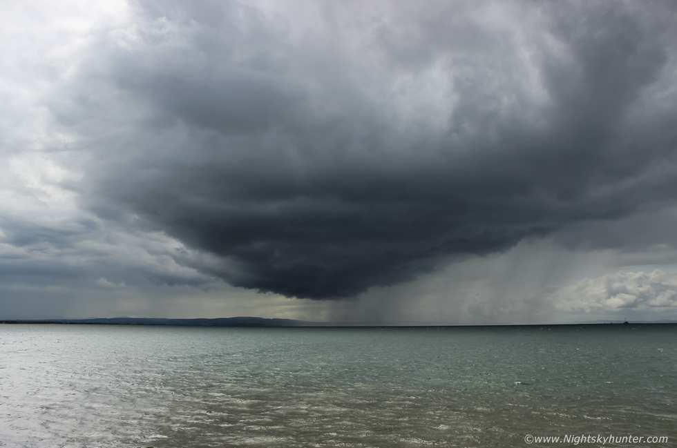 |
This is how quickly the weather changed here in response to solar heating, convergence and 400 CAPE on a SWly flow meeting an on-shore NEly breeze. This cell looked extremely mean and dark as it rapidly formed over the water then slowly moved Left to right across the Foyle. The atmosphere was warm and calm then suddenly Summer went to Autumn as the cold downdraught from this cell blasted across the water, it's outflow whipping across the shore at +30mph and sustained like this for 15 min's. I had the DSLR mounted on a large rock shooting time lapse and the camera/tripod almost blew over, but it was a great time lapse test, this was 10mm wide angle, the black clouds contrasted dramatically against the metallic green water below, I really liked this scene, also it's the first proper surface based mean looking cell I have captured this season, once it passed Autumn turned back to Summer.
 |
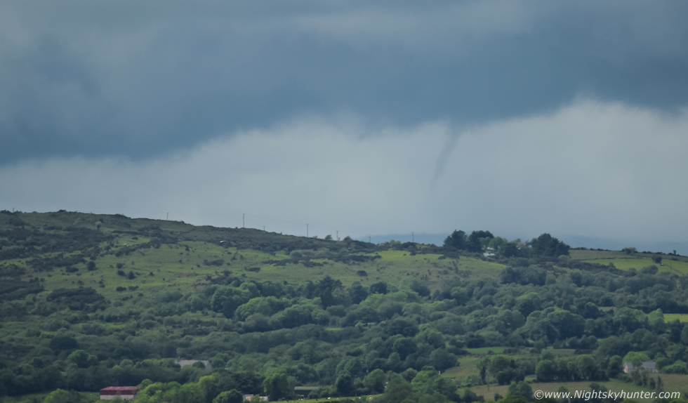
May 5th, no chance of storms, unstable air with pockets of 200 CAPE and capping once more, however models were showing convergence to the west midlands, John Fagan and I were chatting and deciced to keep an extra close eye on the sky for funnel clouds. Meanwhile during the early afternoon Roisin and I drove through Cookstown, we had groceries to get and normally we would get these done first before anything else, however today Roisin decided she wanted a walk first so we headed to Tullyhogue ring fort outside of town. The day was dry, warm, slightly humid and very slack with barely a breeze, the skies were lined with numerous rows of cumulus cloud streets with well defined bases, the towers were short but trying to grow, I said to Roisin these were good conditions for funnels. I grabbed by DSLR and 100-400mm lens then we walked up the path to the top of the hill near the fort. It was a beautiful day in the countryside with nice air, green fields and Sheep chewing cud peacefully beside us, we stood here taking in the view for 15 minutes.
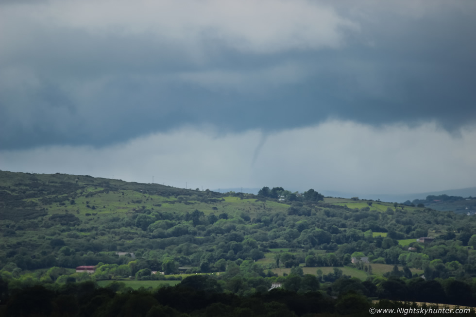
I scanned every cloud base relentlessly, we watched a nice Lamb bouncing around the field beside it's Mother which was a nice sight, I noticed the towers were smaller in the E but to the W they were taller and stacking up in a certain location on the horizon with a nice dark solid rain free base. I turned my back to them and scanned the E once more, then turned around back to the W and there was a funnel!!!, I shouted to Roisin ''holy s**t there's a funnel''. During my first few seconds of seeing it I was awestruck because it looked to be almost touching the ground!, it was extremely well defined with sharp edges and curved gracefully towards the surface, clear as day, I grabbed my camera, took off the 10mm, attached the 100-400mm, adjusted settings and began taking shots, by this stage it was already past its most photogenic stage and beginning to retreat back up to the base, but I got before it did so! the funnel was many miles away on the horizon but stood out very clear with the naked eye, the above image was at 400mm, the cloud base was moving from left to right.
 |
Another image this time slightly cropped, the auto focus was out a touch but had I spent time trying to manually focus this lens I would have got no images at all.
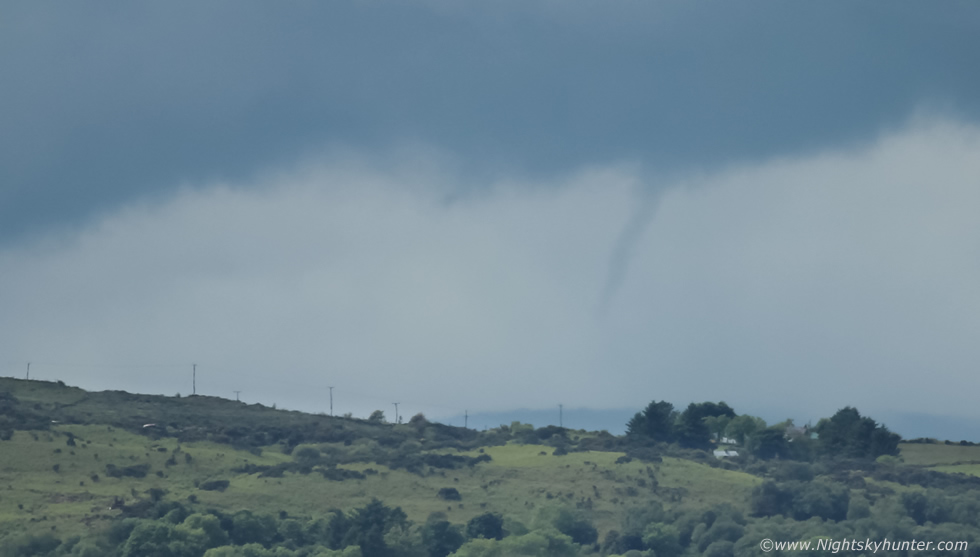 |
Tighter crop from a third image, in total I got six stills before it went back into the base and vanished for good, it actually was a stunning sight visually despite its fleeting performance, I couldn't believe I had just captured my third funnel of the season, this one was clearly the best of the trio. I checked radar when I got back, in the distance behind this base there where two showers with red cores and at the time of the funnel observation (14.55 BST) this would put the funnel approximately over the Omagh road area precisely between Cookstown and Omagh. If only it had been closer it would have been a much more epic catch, there's a chance this could have touched the ground as a weak tornado however without an eyewitness at the scene I will never know.
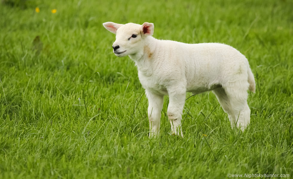 |
I was on a high from the sighting, I went out looking for funnels and got one within 15 min's, that's incredible good fortunate, I think it was meant to happen because if Roisin wanted to go shopping first we never would have been here in time to see it, also if I hadn't of listened to my instincts and didn't carry the camera and lens to the fort with me I also would never have got it on camera, funny how things work out. Roisin believes it was the Lamp who brought us the good luck, here he is loving life in this peaceful field near a famous megalithic site.
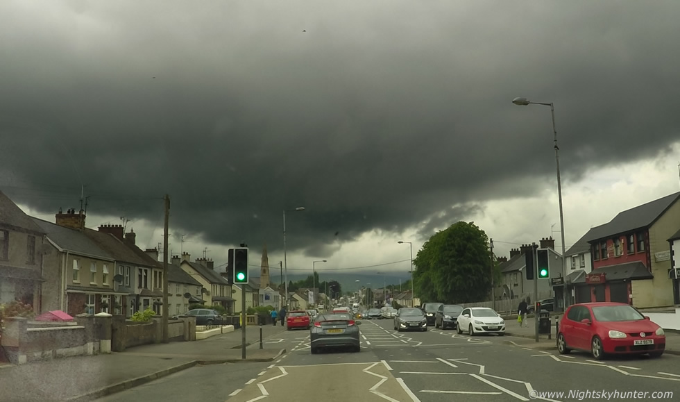 |
Then we drove into Cookstown to do that shopping and by pure chance we met that line of towers which had produced the funnel, now they where over the town and looked very dramatic with a nasty black updraught base. I was filming with the window mounted Go Pro and got these stills for the record.
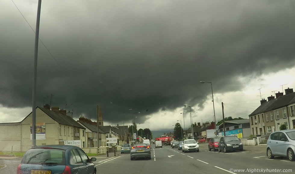 |
The meanest storm clouds I have seen this year without question, that base was very low and I could see the tapered end rotating behind the chapel spire while the surrounding scud was being lifted up into the base, I had to pull over in the town centre and watch the rotation with camera in hand in case it dropped another funnel, however after 15 min's a big downpour started and we were under heavy rain so we called it a day, not a bad result at all.
Go Pro video time lapse of the convection on Benbradagh during one of my long solo funnel watches
Vlog and time lapse from our chase at Mullaghmore in Co. Sligo
DSLR time lapse of storm clouds and convection at Magilligan Point and Lough Foyle with vlog during a storm and convergence zone funnel watch.
Vlog recorded just minutes after shooting the distant funnel cloud near Cookstown from Tullyhogue Fort with still images and Go Pro footage of the storm base over the town itself. This wraps up the first part of the 2017 storm season, a season which has been tough with very little in the way of storms and photogenic scenes, however I did my best and still captured what I could and succeeded with these three funnel cloud days. The season is still young for June, July and August always produce the finest storms and on occasion September and early October can even produce big events so now the batteries are charged and I'm ready for the next chase day, thanks very much for reading.
Martin McKenna